
Source material.
#027

Last Sunday, I made a research trip down to McDowell County (the Free State of McDowell) for my Tug Fork project. I’m usually an early riser and when travel is involved, I like to have a plan and start that plan as early as possible. Instead, I began my day at a leisurely pace, changed the oil in my truck, and didn’t get on the road until 1 p.m.
This is only significant (to me) because it’s part of the middle path I’m trying to lean into (fluidity vs. rigidity). It’s just over a two and a half hour drive, which gave me about four hours of working daylight to make pictures in and five plus hours of time to think, dream, and listen while driving. I spend a lot of time thinking and driving.
The source of the Tug Fork is located just outside the community of Jenkinjones near the southernmost part of West Virginia. Named for a Welsh coal baron who moved to the United States during the Civil War in 1863, the town at one time boasted some 4,000 residents, two company stores, and a movie theater.
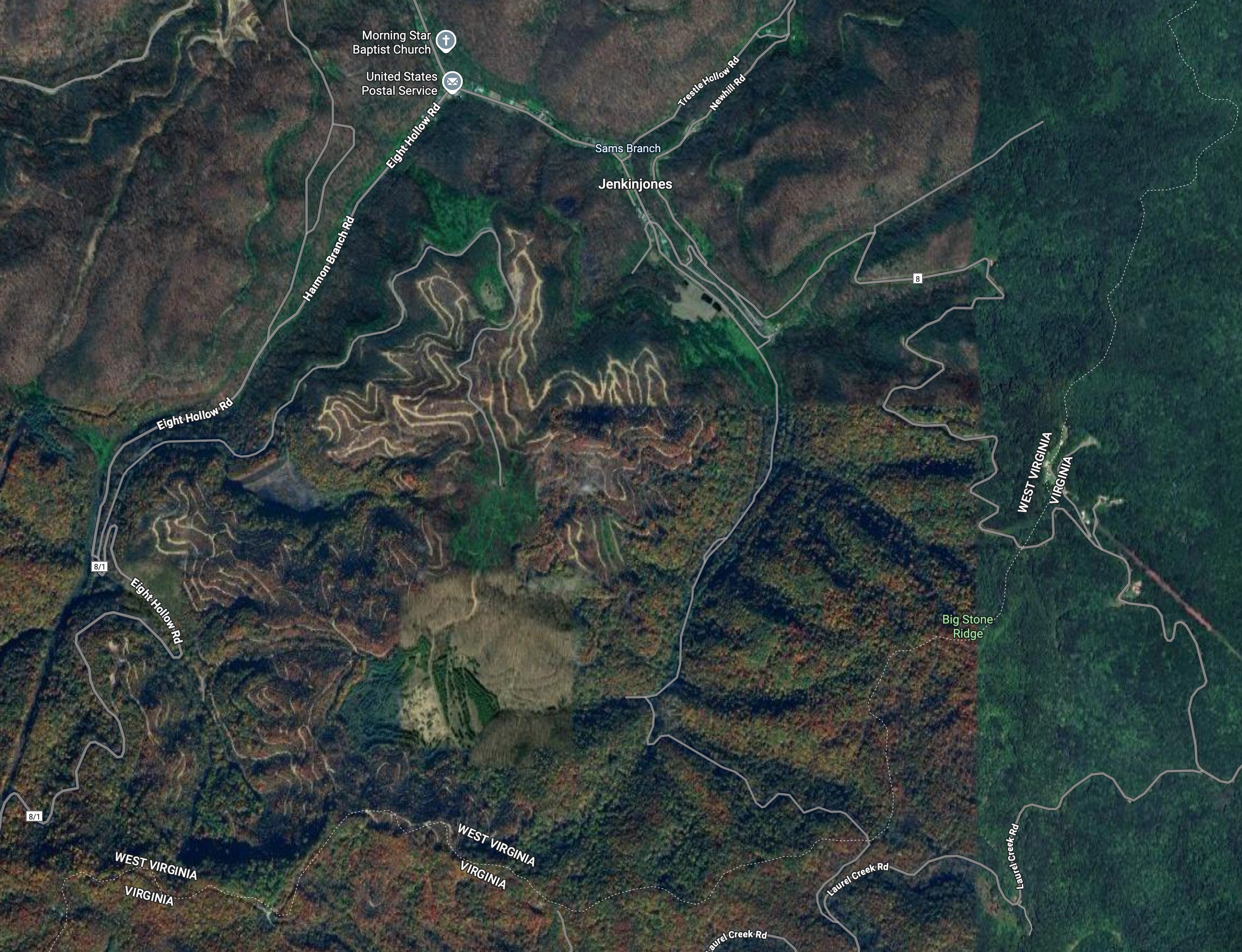
From Jenkinjones, the Tug Fork flows north toward Welch and on to Iaeger (pronounced like Yeager), where it meets the Dry Fork (also labeled on Google Maps as Tug Fork, which can be confusing). Moving northward, it serves as the state line between West Virginia and Virginia for some four miles before becoming the border between West Virginia and Kentucky. At Fort Gay, West Virginia, it meets the Levisa Fork and the two rivers form the Big Sandy, which flows into the Ohio and on to the Mississippi River.
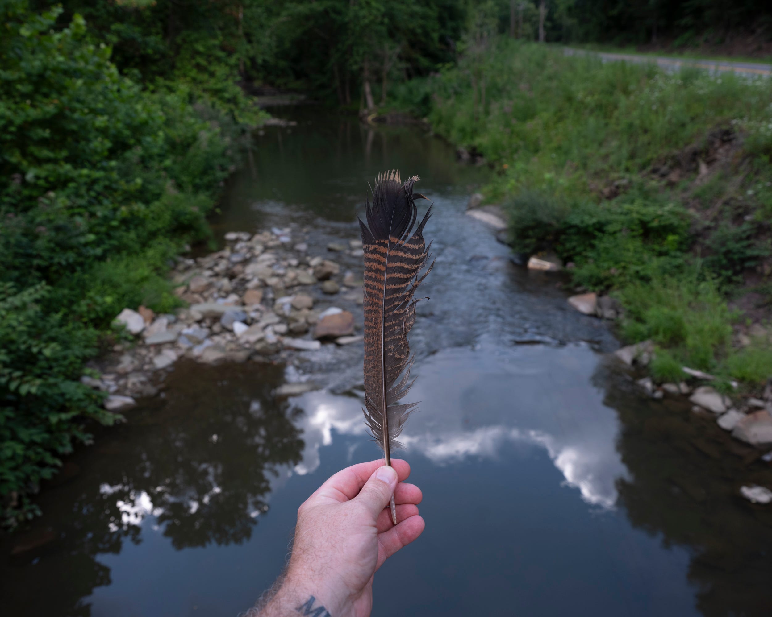
I needed this trip to feel like the work was actually in motion. I decided not to venture all the way to the source of the Tug Fork, but I did make it about three quarters of a mile from it. The excessive heat, being alone, and not having snake boots made my decision easier. It helped ground me to the place and helped me visualize the broader arc of the river from near its source to its mouth (which I visited several weeks ago).
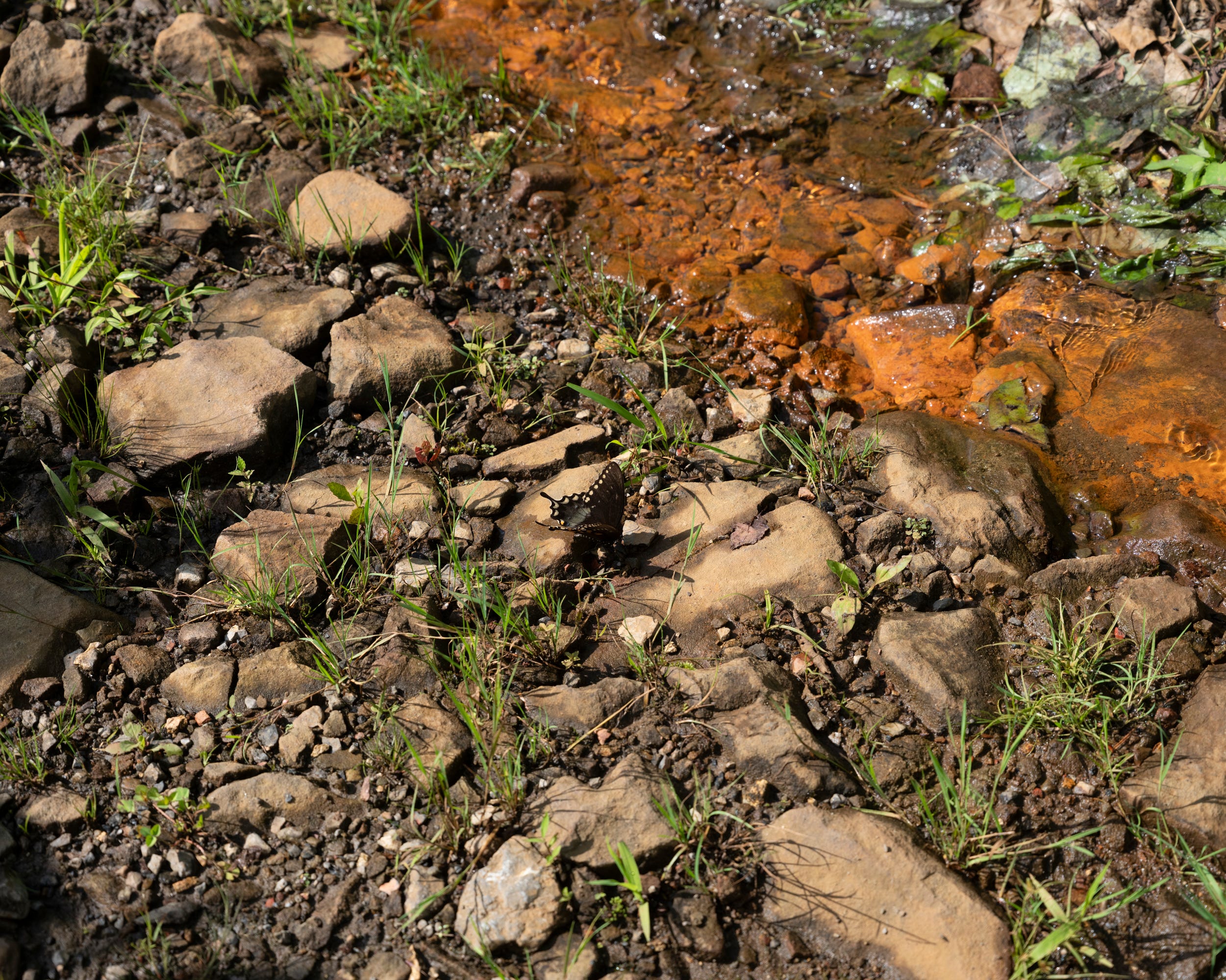
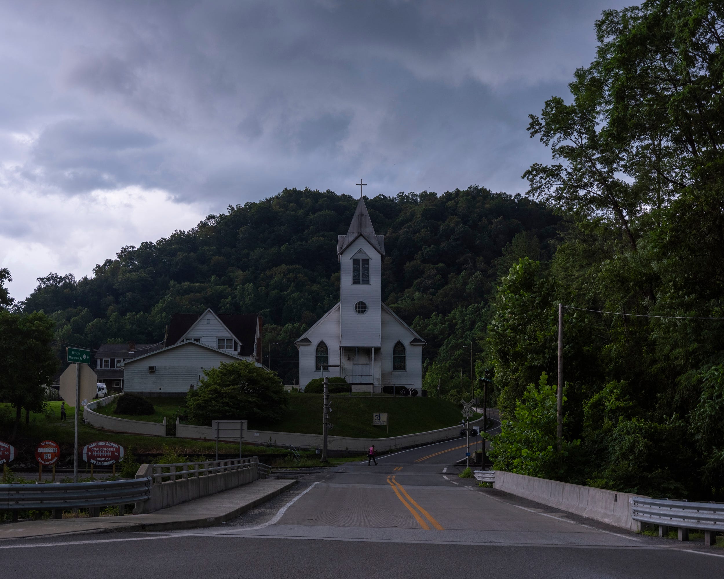
After making some pictures and notes in Jenkinjones and Anawalt, I started my way back north. I pulled into the Bantam Market in Gary to grab a turkey sandwich as storm clouds rolled in. Just before the lightning and rain started, I made a few pictures of Our Lady of Victory along Miracle Mountain Road. The bridge in the foreground crosses the Tug Fork.
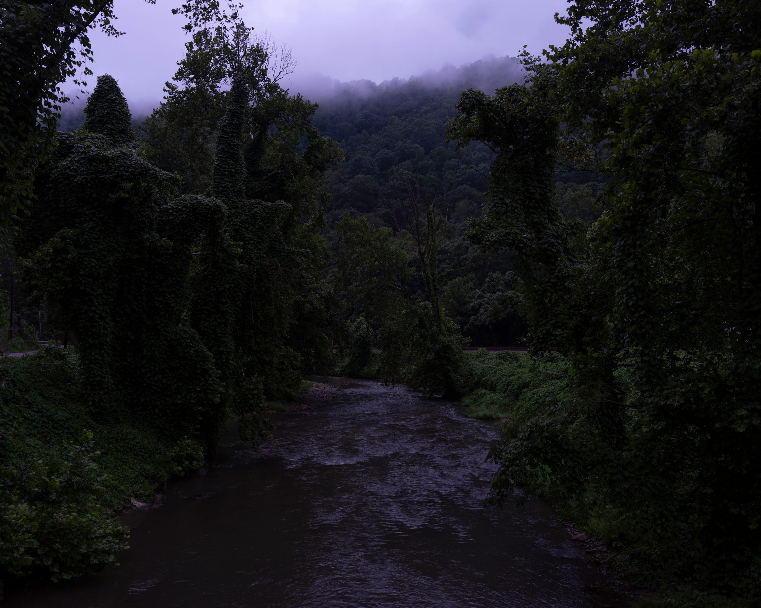
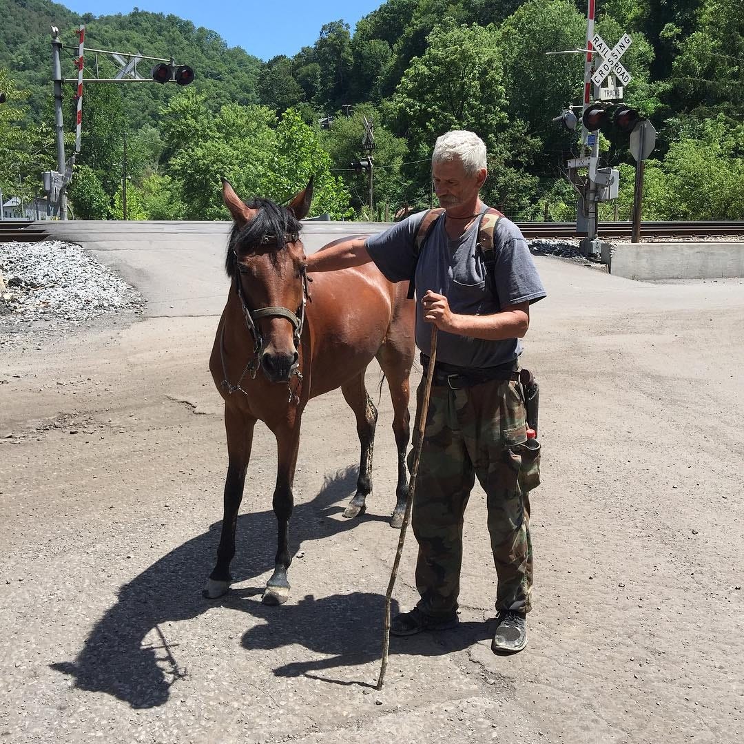
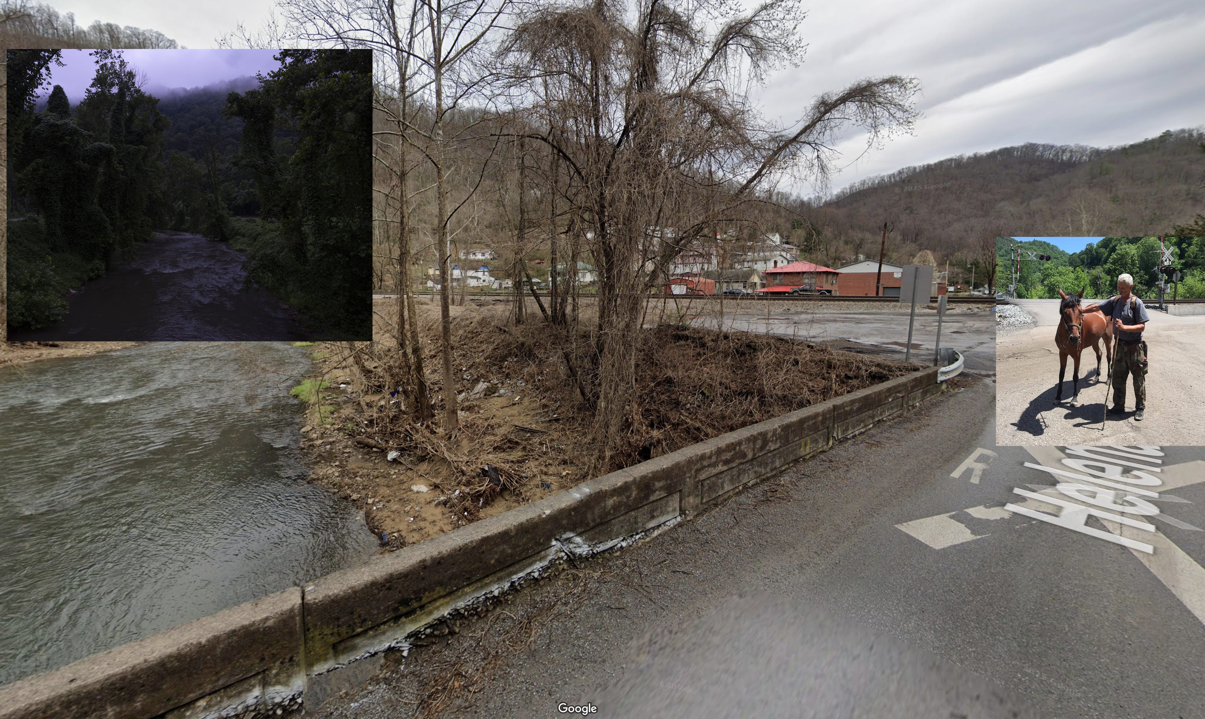
A few hours and a few stops later, I stood on a bridge in Davy and made some pictures of the Tug Fork in the light that was left. Almost exactly 10 years ago, I made a picture near this same bridge where I met Dennis Mahaffey and his horse, McKinley Starr. McKinley got loose in the night and wandered about four miles away from home. When I met Dennis, he was walking her home.
Here’s a composite of the two photographs and their proximity to one another.
It feels good to dig into this work and to familiarize myself even more with the river I thought I knew so well. I like the part of a project where I still have more questions than answers and more ideas about how the body of work could unfold. I haven’t made any portraits for this project yet, so if you’re reading this and live along the Tug Fork and would consider having your picture made, please drop me a line.
I made it back home just after 11 p.m., my head and heart full of possibility. I’m already planning my next trip back to Jenkinjones and to the source of the Tug Fork.
- Roger
The Ground at My Feet is a reader-supported publication. To receive new posts and support my work, please consider becoming a free or paid subscriber.
Thank you for this lovely history of the Tug. I didn't know it began in Jenkinjones. You know he lived in Bramwell. And the Welsh folks here used to speak in their native tongue to each other on the telephone so the operators couldn't listen in on their conversations. 😊
I know very little about southern West Virginia. I was sent by my parents to summer camp called John Laing in Comfort but couldn't wait to get home to Charleston. I'm glad to read of an area that was unfamiliar to me.